The map below displays the best available information on the location of lead service lines in our water system. The information on the map comes from a combination of historical property data, construction records and results from curb box inspections. The map also shows where we have already replaced lead lines and where we plan to replace lead lines.
Please note many of the historical records are from when the property was originally constructed and are no longer accurate. We will continue to update the map as more information is available.
For instructions on how to use the map below, click here.
To see a full-size version of the lead map, click here.
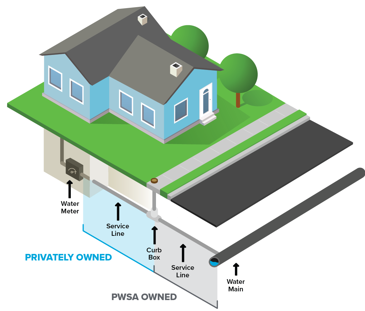
The portion of the water service line that is public and owned by PWSA runs from the water main in the street to the “curb box” (water service shutoff valves, usually located in the sidewalk between the water main and the building). The remainder of the line that connects from the curb stop to the building is considered private property.
If you are not within one of our completed or upcoming work areas, we offer income-based private lead service line replacement programs to help you get the lead out fast. For more information, read about our Lead Service Line Reimbursement Program.